Blue Mountains
Blue Mountains
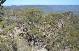
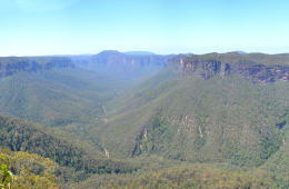
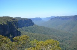
The Greater Blue Mountains Area consists of 10,300 square kilometres of mostly forested landscape on a sandstone plateau 60-180 km inland from the Sydney CBD. They are part of the Great Dividing Range, bounded by the Nepean and Hawkesbury Rivers in the east, the Coxs River and Lake Burragorang to the west and south, and the Wolgan and Colo Rivers to the north.
It was listed as a World Heritage Area by UNESCO on 29 Nov 2000, becoming the fourth area in New South Wales to be listed. The area is made up of 7 national parks (the Blue Mountains, Kanangra-Boyd, Wollemi, Gardens of Stone, Yengo, Nattai and Thirlmere Lakes National Parks) as well as the Jenolan Caves Karst Conservation Reserve.
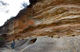
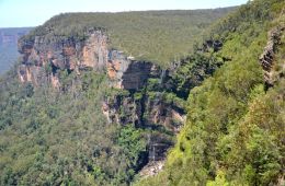
Archaeological studies indicate that the Blue Mountains were formed around one million years ago as part of the Kosciusko Uplift during the Pliocene Epoch. Pressure from the east raised the area upwards in a monoclinal fold, reaching an elevation of around 3000 feet where Mount Victoria is today. A sandstone plateau, topped with basalt outcrops on the higher ridges, was formed. This became deeply incised by gorges up to 760 metres deep. This plateau is thought to have enabled the survival of a rich diversity of plant and animal life by providing a refuge from climatic changes during recent geological history.
The Blue Mountains were originally named “Carmarthen Hills” and “Landsdowne Hills” in 1788 by Governor Phillip. Its name was changed to Blue Mountains not long after, due to the distinctive blue haze surrounding the area. The Blue Mountains is densely populated by oil-bearing Eucalyptus trees which fill the atmosphere with finely-dispersed droplets of essential oil when the temperature rises. Together with dust particles and water vapour, the oil droplets scatter light rays of short-wave length which appear predominantly blue in colour.
The Blue Mountains were first inhabited by the Daruk tribe, as evidenced by rock-carved aboriginal art such as a remarkably-preserved ancient rock carving known as the “flight of the Great Grey Kangaroo“, located at the foot of Hawkesbury Lookout near Winmalee.
Between 1770 (when Captain Cook landed) and 1813, the Blue Mountains were seen as an impassible barrier for future exploration due to its rough terrain and lack of resources. In 1813, Gregory Blaxland, William Charles Wentworth and Lieutenant Lawson set off with four servants, four pack horses and five dogs on an exploration which was to create history. On 11 May 1813, the explorers departed from Emu Plains reaching the foothills of the Blue Mountains where Glenbrook is located today. The trek across the Blue Mountains was a tremendous struggle – challenged with insufficient food, constant hacking through thick scrub, treading through damp dew-laden undergrowth and in constant fear of attack by Aborigines. These rugged terrain together with sickness nearly defeated the men. Eighteen days later on 29 May 1813, the Blue Mountains was no longer considered an impassible barrier following the discovery of the gently sloping mountains to the west. Today, just west of Katoomba you can see the remains of a Eucalyptus tree marked by the famous explorers Blaxland Wentworth and Lawson. This marked tree, along with Caley’s Repulse at Lawson, are the only remaining marks of the early explorers.
Blackheath Memorial Park
Local indigenous people of the Darug tribal group are believed to have used this area as...
Campbell Rhododendron Gardens
The Campbell Rhododendron Gardens are located in Bachante Street, Blackheath, just a...
Shipley Plateau
On the south western side of Blackheath, past the tiny hamlet of Shipley, are two lesser...
Wind Eroded Cave
From the same carpark as for the Anvil Rock, a sign to the left marks the way for a...
Anvil Rock
Anvil Rock (GPS: 33.595487°S 150.339451°E) is an often overlooked attraction of the Blue...
Perrys Lookdown
Perrys Lookdown is located in Blackheath at the end of a 8 km dirt road Anvil Ridge...
Evans Lookout
Evans Lookout, located at the top of the escarpment at the end of Evans Lookout Road...
Govetts Leap
From Blackheath town centre, a short drive to the east takes visitors to Govetts Leap...
Blackheath
Blackheath is located near the highest point (1065 metres) of the Blue Mountains,...

